Habib Rezai · OUTNUMBERED

Digitale cartografieën

OUTNUMBERED

een bezwaarschrift op ruitjespapier

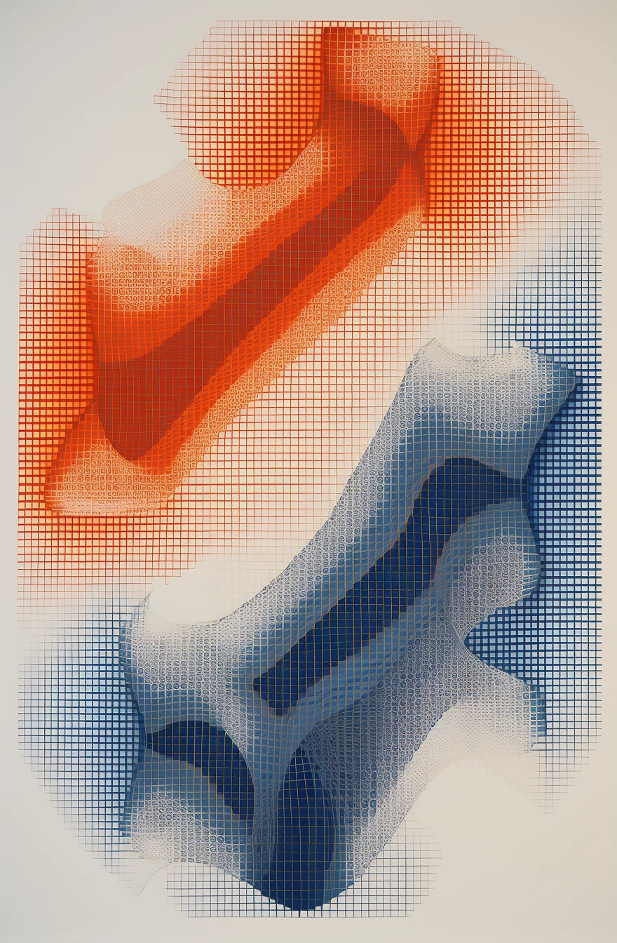
Een reeks cartografieën waarin plaats, kleur en een wiskundig raster op elkaar inwerken. Waar een vorm verschijnt, buigt het raster mee.

Cartografie uit OUTNUMBERED: een blauwe en een oranje vorm op ruitjespapier, het raster buigt mee

Over het werk

OUTNUMBERED is een reeks digitale cartografieën. Elk werk vertrekt vanuit een plek waar ik heb gewoond. Coördinaten, twee kleuren en een wiskundig raster verhouden zich tot elkaar. Het zijn geen landkaarten. Ze gaan over hoe een plek iemand vormt, en hoe iemands aanwezigheid die plek verandert.

Het raster is het ruitjespapier waarop ik als scholier tekende. Het is ook de maat waarmee mensen worden ingedeeld: in klassen, statussen en categorieën. In deze werken blijft dat raster niet recht.

Blauw verwijst naar mijn Hazara-afkomst, oranje naar Nederland. Ze ontmoeten elkaar, schuren en mengen, en in geen twee werken is hun verhouding gelijk. Soms vloeien ze in elkaar over. Soms liggen ze als vakjes naast elkaar, zonder één kleur te worden.

De titel gaat over het gevoel niet mee te tellen, en over de omkering daarvan. Wat gebeurt er met het kader als de vele mensen die zich ieder afzonderlijk een minderheid voelen, samen worden geteld?

Habib Rezai

De atlas

De atlas telt 28 cartografieën, één voor elke verhuizing. Hieronder een selectie van twintig.

Deelnemend werk

Het 29e werk

Bezoekers voeren hun eigen plaatsen in, van geboorteplaats tot nu, en zien hun reis veranderen in een cartografie. Wie wil, voegt die reis toe aan één gezamenlijk vel dat gedurende de tentoonstelling verschuift. Op de slotdag is het werk af.

Er worden geen plaatsen of namen bewaard.

Maak je cartografie ↗

In ontwikkeling: vijf grote, fysieke werken die de atlas verdiepen, en één slotdoek.

Digital cartographies

OUTNUMBERED

an objection written on squared paper

A series of cartographies in which place, colour and a mathematical grid act on one another. Where a form appears, the grid bends with it.

Cartography from OUTNUMBERED: a blue and an orange form on squared paper, the grid bending with them

About the work

OUTNUMBERED is a series of digital cartographies. Each work starts from a place where I have lived. Coordinates, two colours and a mathematical grid act on one another. These are not maps. They are about how a place shapes a person, and how a person's presence changes that place in return.

The grid is the squared paper I drew on as a schoolboy. It is also the measure by which people are sorted: into classes, statuses and categories. In these works the grid does not stay straight.

Blue refers to my Hazara origins, orange to the Netherlands. They meet, rub against each other and mix, and no two works hold them in the same balance. Sometimes they flow into each other. Sometimes they sit side by side as separate squares, without becoming one colour.

The title is about the feeling of not being counted, and about reversing it. What happens to the frame when the many people who each feel like a minority are counted together?

Habib Rezai

The atlas

The atlas comprises 28 cartographies, one for each move. Shown here: a selection of twenty.

Participatory work

The 29th work

Visitors enter the places they have lived, from birthplace to now, and watch their journey become a cartography. Those who wish can add their journey to a single shared sheet that shifts over the course of the exhibition. On the closing day, the work is finished.

No places or names are stored.

Make your cartography ↗

In development: five large physical works that deepen the atlas, and one final canvas.

نقشه‌نگاری‌های دیجیتال

OUTNUMBERED

اعتراض‌نامه‌ای روی کاغذ شطرنجی

مجموعه‌ای از نقشه‌نگاری‌ها که در آن مکان، رنگ و یک شبکهٔ ریاضی بر یکدیگر اثر می‌گذارند. هر جا شکلی پدیدار می‌شود، شبکه نیز با آن خم می‌شود.

نقشه‌نگاری از OUTNUMBERED: شکلی آبی و نارنجی روی کاغذ شطرنجی که شبکه با آن خم می‌شود

دربارهٔ اثر

OUTNUMBERED مجموعه‌ای از نقشه‌نگاری‌های دیجیتال است. هر اثر از جایی آغاز می‌شود که در آن زندگی کرده‌ام. مختصات جغرافیایی، دو رنگ و یک شبکهٔ ریاضی با یکدیگر نسبت می‌یابند. این‌ها نقشهٔ جغرافیایی نیستند. دربارهٔ این‌اند که یک مکان چگونه انسان را شکل می‌دهد، و حضور انسان چگونه آن مکان را دگرگون می‌کند.

این شبکه همان کاغذ شطرنجی است که در دوران مدرسه روی آن نقاشی می‌کردم. همچنین معیاری است که با آن آدم‌ها دسته‌بندی می‌شوند: در کلاس‌ها، وضعیت‌ها و مقوله‌ها. در این آثار، شبکه صاف نمی‌ماند.

رنگ آبی به ریشهٔ هزاره‌ای من اشاره دارد و نارنجی به هلند. این دو به هم می‌رسند، به هم می‌سایند و در هم می‌آمیزند، و در هیچ دو اثری نسبتشان یکسان نیست. گاهی در هم جاری می‌شوند. گاهی چون خانه‌هایی جدا کنار هم می‌نشینند، بی‌آنکه یک رنگ شوند.

عنوان اثر از احساسِ به حساب نیامدن سخن می‌گوید، و از وارونه کردن آن. چه بر سر چارچوب می‌آید اگر انسان‌های بسیاری که هر یک خود را در اقلیت می‌دانند، با هم شمرده شوند؟

حبیب رضایی

اطلس

اطلس از ۲۸ نقشه‌نگاری تشکیل شده است، یکی برای هر جابه‌جایی. در اینجا گزیده‌ای از بیست اثر را می‌بینید.

اثر مشارکتی

اثر بیست‌ونهم

بازدیدکنندگان مکان‌هایی را که در آن زندگی کرده‌اند، از زادگاه تا امروز، وارد می‌کنند و می‌بینند که سفرشان به یک نقشه‌نگاری تبدیل می‌شود. هر کس بخواهد، می‌تواند سفر خود را به یک برگهٔ مشترک بیفزاید که در طول نمایشگاه جابه‌جا می‌شود. در روز پایانی، اثر کامل می‌شود.

هیچ مکان یا نامی ذخیره نمی‌شود.

نقشه‌نگاری خود را بسازید ↗

در دست ساخت: پنج اثر بزرگ فیزیکی که اطلس را ژرف‌تر می‌کنند، و یک بوم پایانی.